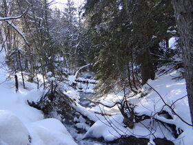
The “Bugeon” stream via “Le Praz” hamlet (17)
Saint François Longchamp
[Saint-François-Longchamp area]
A red level itinerary, around 3:30h long and with a positive and negative elevation of 420m. Adapted to most of the people, it is better to have a small experience of hiking.
Starting point at the «Place de la Madeleine». Take the track on the right of the Odalys Bellevue building. At the first intersection, take on your right towards the «Cochenières» hamlet and the «Replat». Reach the road and continue on your left in the direction of «Le Praz» and the Montgellafrey Village. At the level of the Praz, take the track going down towards the Bugeon stream. Cross a little wooden brigde at the place called «Les Moulins». Then take the path going up and catch up with the departemental road. Go up to the resting area of the «Cheminées de Fées». Cross it and take the «Chemin des Paquiers» going down to the Bugeon Stream. Follow the path up to the «accrobranche» park and reach the «Place de la Madeleine».
Dogs are allowed. They must be kept on leash.
See more
73130
Services
- Pets welcome
Prices
Free of charge.
Opening Time
From 01/07 to 31/08.
Dogs are allowed. They must be kept on leash.
Spoken languages
-
 English
-
 French